


China Topgraphic Map
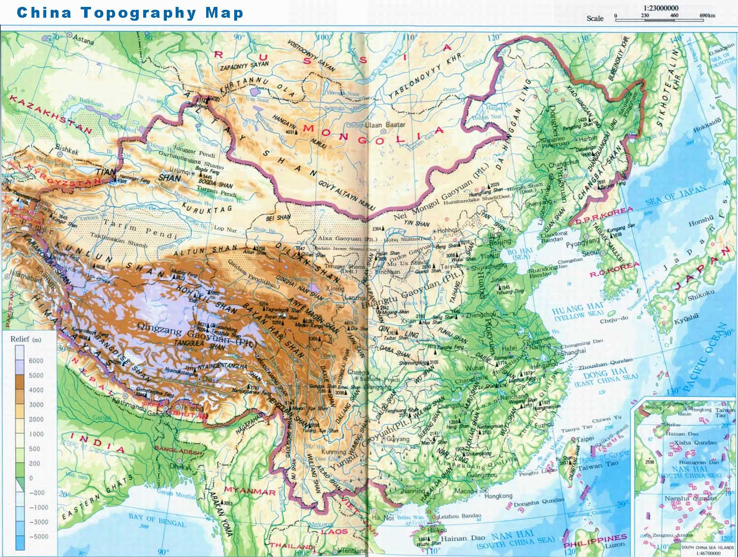
See the above ChinaTopographic Map. The vast land expanses of China include plateaus, plains, basins, foothills, and mountains. Defining rugged plateaus, foothills and mountains as mountainous, they occupy nearly two-thirds of the land, higher in the West and lower in the East like a three-step ladder.
The highest step of the typical 'ladder topography' is formed by the Qinghai-Tibet Plateau at the average height of over 4,000 meters, with the Kunlunshan range, Qilianshan range and Hengduan mountain chain as the division between this step and the second one. The highest peak in the world, Everest, at 8844.43 meters high is known as 'the Roof of the World'.
On the second step are large basins and plateaus, most of which are 1,000 - 2,000 meters high. The Daxing'an, Taihang, Wu and Xuefeng Mountains divide this step and the next lower one. Plateaus including Inner Mongolian, Loess, Yungui Plateaus, and basins such as Tarim, Junggar, and Sichuan Basins are situated here.
The third step, abundant in broad plains, is dotted with the foothills and lower mountains, with altitudes of over 500 meters. Here are located famous plains: the Northeast, the North China, and the Middle-Lower Yangtze Plains, neighboring with each other from north to south. These well-cultivated and fertile lands produce abundant crops.
 Ask Questions ?