
Skype: neodalle-travel
Tel: +86 135 7447 2266
E-mail: sales@visitaroundchina.com

 Situated in eastern Asia,and on the western shore of the Pacific Ocean, the People’s Republic of China covers a land area of 9.6 million square kilometers, with an inland and coastal water area of more than 4.7 million square kilometers and an eastern and southern continental coastline extending for about 18,000 kilometers. Its vast maritime territory is studded with 7,600 islands, of which Taiwan is the largest with an area of 35,798 square kilometers.
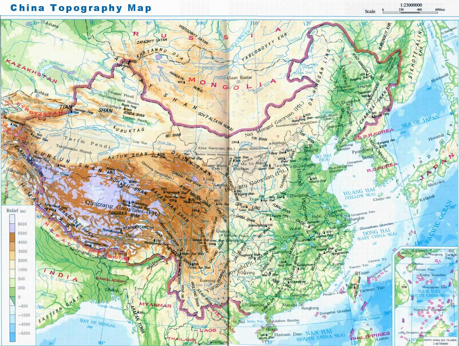
The first step of the typical 'ladder topography' is formed by the Qinghai-Tibet Plateau at the average height of over 4,000 meters, with the Kunlunshan range, Qilianshan range and Hengduan mountain chain as the division between this step and the second one. The highest peak in the world, Everest, at 8844.43 meters high is known as 'the Roof of the World'.
The second step are large basins and plateaus, most of which are 1,000 - 2,000 meters high. The Daxing'an, Taihang, Wu and Xuefeng Mountains divide this step and the next lower one. Plateaus including Inner Mongolian, Loess, Yungui Plateaus, and basins such as Tarim, Junggar, and Sichuan Basins are situated here.
The third step, abundant in broad plains, is dotted with the foothills and lower mountains, with altitudes of over 500 meters. Here are located famous plains: the Northeast, the North China, and the Middle-Lower Yangtze Plains, neighboring with each other from north to south. These well-cultivated and fertile lands produce abundant crops.
Mountainous Topography
Click the China Topgraphic Map, you can learn more about geopgraphy of China. There are many mountain ranges in China. Those extending from east to west are the Tianshan-Yinshan ranges and those in the center are the Kunlun-Qinling ranges, and those in the south are the Nanling ranges. Ranges that stretch in a NE-SW direction are, for the most part, located in the eastern part of China. They are the Greater Hinggan Range, Taihang, Wushan, Xuefengshan, Changbaishan and Wuyishan ranges. Those running in a NW-SE direction are the Altai and Qilianshan ranges. Ranges that run in a north-south direction are the Hengduanshan and Helanshan 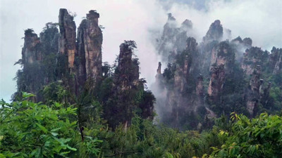 ranges. And on the border between China and India, Nepal and other countries looms the 2, 400 kilometers-long Himalayan Range with an average elevation of 6, 000m.
Among these mountains, some reach to the sky, and others are lower with charming scenery. Out of the mountains throughout the world at the altitude of over 7,000 meters, over 50 stand in China. To the east in China, lower mountains like Mt.Tianzishan, Mt Fanjingshan, Mt. Huashan, and Mt. Emeishan, also display their unique beauty. In addition, they hide rich treasures including botanic, zoologic, and mineral resources.
Islands & Straits
With a total length of more than 18,000 kilometers, the coastline of mainland China starts from the mouth of Liaoning Yalu River in the north and reaches the mouth of Guangxi Beilun River in the south. China has a total sea area of 4.73 million square kilometers, and there are thousands of islands in China, which mainly include Taiwan Island, Hainan Island, Diaoyu Island, Huangyan Island, Zhoushan Islands, Nanri Islands, Xisha Islands, Nansha Islands, Dongsha Islands, Zhongsha Islands, Penghu Islands and so on. In addition, there are the Three Straits such as the Bohai Strait, Taiwan Strait and Qiongzhou Strait.
Regional Divisions
Usually, people tend to divide China into four regions, that is, the North, South, Northwest and the Qinghai-Tibetan areas. Because of geographical differences, residents of each region have distinctive life styles and customs.
The North and South regions are located in the Eastern monsoon area and are divided by the Qinling Mountains-Huai River. Nearly 95 percent of the Chinese population lives here. The other two regions, the Northwest and Qinghai-Tibetan regions that occupy 55 percent of the land, have fewer people, although most of the ethnic groups cluster there.
 Ask Questions ?


