
Skype: neodalle-travel
Tel: +86 135 7447 2266
E-mail: sales@visitaroundchina.com
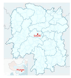 Loudi Position Map
Loudi city is situated in the center of Hunan Province, neighboring six cities in the surrounding area: Xiangtan and Changsha in the northeast, Hengyang in the southeast, Yiyang in the northwest, Shaoyang in the southwest and Huaihua in the west.The western region of the city borders the mountainous area in western Hunan, while the land in the central and east is hilly, with gently sloping topography.
Loudi Tourism Map
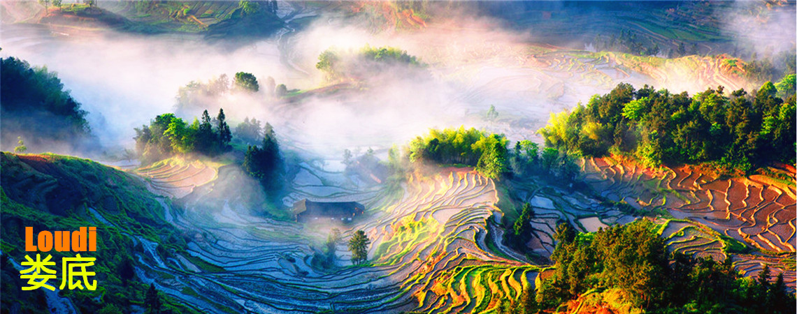
Loudi is skirted by mountains and waters, presenting picturesque landscapes. Tourist attractions in Loudi 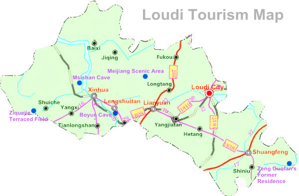 include Dacheng Mountain, Boyue Cave Scenic Area, Meijiang River Scenic Area, Daxiong Mountain National Forest Park, and Longshan National Forest Park. In addition, Loudi has also preserved Ziquejie terraced fields in the high mountain with a history of over 1,000 years, which have been listed as a national cultural heritage, displaying the great strength of human beings in transforming nature.
The time-honored history and splendid Hunan culture and Meishan culture have given birth to Loudi's historic and cultural sites. The three main tourist attractions—the Meijiang River, Shuifu Temple and the former residence of Zeng Guofan—are quiet, secluded and elegant, adding radiance and beauty to each other. Today, Loudi, known as the "capital of antimony in the world", the "100-mile coal sea", and the "10-mile Iron City", is showing its brilliant glamour with the rising industrial tourism industry.
 Ask Questions ?


