
Skype: neodalle-travel
Tel: +86 135 7447 2266
E-mail: sales@visitaroundchina.com

Skype: neodalle-travel
Tel: +86 135 7447 2266
E-mail: sales@visitaroundchina.com

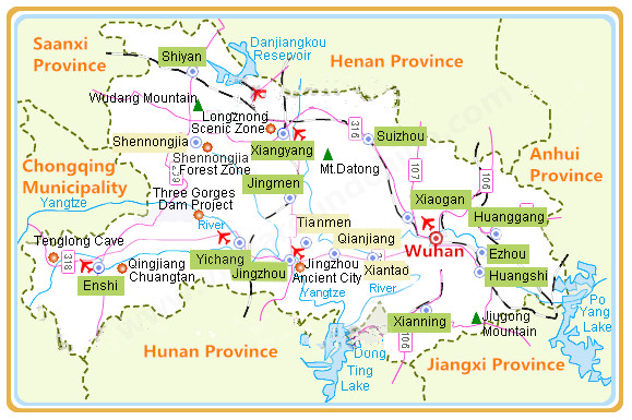
Hubei Province Map
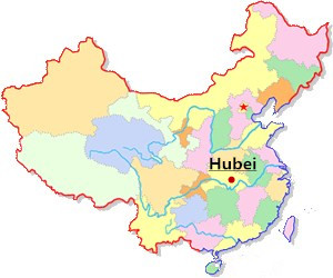
Location map Hubei
Hubei Province is located in the middle reaches of the Yangtze River and to the north of Dongting Lake, south cantral of China. It is surrounded by Henan Province to the north, Jiangxi and Hunan Province to the south, Anhui Province to the east, Sichuan and Chongqing to the west, Shaanxi Province to the northwest.
 Ask Questions ?
Home | About Us | Contact Us | Why Choose Us | Sitemap | Links
Copyright © 2010-2020. All Rights Reserved to Zhangjiajie Holiday
Travel Agency License: L-HUN-CJ00010 | Zhangjiajie China Travel Service Co.Ltd
Address: 4/F,The Building of Zhangjiajie Bus Station,Guanliping, Yongding District, Zhangjiajie City, Hunan Province,China | Post Code:427000
Tel: +86 744 8399989 8399969 | Fax: +86 744 8399986 | E-mail: sales@visitaroundchina.com DMOZ


