- Home
- Province Guide > Liaoning >
Geography of Liaoning
Liaoning Province is located in the south of Northeast China, and borders the Yellow Sea and Bohai Sea to the south. The Liaodong Peninsula is inserted diagonally between the two seas. It is separated from the Bohai Strait and echoes with the Shandong Peninsula. It borders Hebei Province in the southwest, Inner
Mongolia in the northwest, Jilin Province in the northeast, North Korea by the Yalu River in the southeast. The total land area of Liaoning Province is 148,600 square kilometers, accounting for 1.5% of China's total land area.
The terrain of Liaoning Province is roughly sloping from east to west , as well as from north to south. The hills stand on both sides of the east and west, which descends to the central plain, and slope toward the Bohai Sea in a horseshoe shape.
The central plains, constituting part of the Northeast Plain, are the most important area in the province. Structurally, the depression that it occupies is continuous with that of the North China Plain to the southwest, but, topographically, the Liaoning plains are erosional rather than depositional in character. The relief of the plains is undulating but low, and natural drainage is inadequate in many places, creating swamps, some of which have been drained. Undeveloped areas include swamps and sand formations.
The Liaodong Peninsula is a rugged, mountainous area with a rocky coast. The usual elevation of the land is 1,000 to 1,500 feet (300 to 450 metres) above sea level. The rock types are highly mixed, a fact that tends to create a complex and varied topography. Structurally, the peninsula represents a part of the same fold system as Shandong. The coastline is experiencing submergence.
Western Liaoning, fringing the northern shore of Liaodong Bay between Shanhaiguan (Hebei) and Jinzhou, is predominantly a highland area. Those highlands comprise the broken and eroded fringe of the
Mongolian Plateau. They rise in Liaoning to general heights of about 1,500 feet (450 metres). Toward the sea the mountains have been intensely eroded by fast-flowing rivers, so that a complex mass of valleys and ridges has been formed.
The eastern mountain zone lies to the east of Shenyang. The least-developed part of the province, it consists of a complex mountain mass, extending northward into Jilin province, with elevations averaging about 1,500 feet.
Mountains
Mountains and hills with an average elevation of 800 meters and 500 meters are located on both sides of Liaodong (East of Liaoning) and Liaoxi ( West of Liaoning) . Liaohe Plain, with an average elevation of 200 meters, is located in the central part of the province. The coast of the Bohai Sea in Western Liaoning is a long and narrow coastal plain, called the "Liaoxi Corridor."
The mountains in the territory arelocated on the east and west sides of Liaoning Province. The eastern mountain range is the continuation of the Hada Range ( Changbai Mountain branch) and Longgang Mountain. With about 500-800 meters above sea level, it consists of two parallel mountains in the north and south. The major peaks include Laotudingzi Mountain (1325 meters) and Huabozi Mountain (1336 meters) the highest point in the province.
The western mountain range is formed by the transition from the Inner Mongolia Plateau to the Liaohe Plain. The altitude is between 300 and 1,000 meters. They are mainly Nuluerhu Mountain, Songling Mountain, Heishan Mountain and Yiwulu Mountain.
Rivers
There are more than 300 rivers in Liaoning Province, of which 17 have a basin area of more than 5,000 square kilometers. They are mainly the Liao River, Hun River, Daling River, Taizi River, Raoyang River, and the Yalu River, the boundary river shared by China and North Korea. Most of the rivers in the territory merge into the ocean from the east, west, and north directions to the central and southern regions.
The Liaohe River is the longest river in the province, with a total length of 1,390 kilometers, a river course of about 480 kilometers and a drainage area of 69,200 square kilometers.
Ocean & Islands
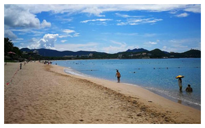
Liaoning Province has a vast sea area, with the Bohai Sea on the west side of the Liaodong Peninsula and the Yellow Sea on the east side. The sea area (continental shelf) covers an area of 150,000 square kilometers. The land coastline extends from the mouth of the Yalu River in the east to Laolongtou in Suizhong County in the west, with a total length of 2292 kilometers.
There are 266 marine islands in Liaoning Province. The main islands are Waichangshan Islands, Lichangshan Islands, Shicheng Islands, Dalu Island, Juehua Island, and Changxing Island.
Soils
The soils of the middle of the Liao lowland are of the calcareous alluvial type; those of the peripheries to east and west are of brown forest types; and those of the northern peripheries are red earths. The swamps have gley soils (having a sticky layer of clay under the waterlogged surface). The soils of the peninsula, like the rock types and the topography, are highly mixed and varied. Most of the best soils there are of brown forest type or of red or yellow loess (an unstratified wind-borne loamy deposit). There has been serious soil erosion, and skeletal soils occur on the steeper slopes.
Plant & animal life
Most of the landscape of the central plains consists of cultivated fields. Wild animals are scarce, apart from rodents. Locusts are the most destructive pest.
The natural vegetation of the Liaodong Peninsula is not well preserved, because of the extent of cultivation and settlement. The forests that remain, mostly on the eastern sides of the hills, contain birches, limes, elms, and pines, together with typical Manchurian trees—oaks, apples, and ashes. On the western sides, trees are scarce. Wild animal life is now meagre, almost limited to rodents. However, a nature reserve centred on Mount Laotie, at the southern tip of the peninsula, is a major stopover for southbound migratory birds from northeastern Asia in autumn. Thousands of birds from more than 200 species, including red-crowned cranes (Grus japonensis) and mandarin ducks (Aix galericulata), rest there before flying farther south. In addition, nearby Snake Island (Shedao), just off the tip of the peninsula, is a breeding ground for thousands of Halys pit vipers (Gloydius halys).
Vegetation is highly mixed in western Liaoning and includes oaks, birches, pines, limes, and spruces. In former times, especially between 1911 and 1948, there was much indiscriminate cutting and thinning of the forests there, so that many areas now have scattered woodland where formerly thick forests stood. The animal life of the western highlands is impoverished by the extent of both forest clearance and human settlement, but it includes wolves, foxes, marmots, and some kinds of deer.
Natural vegetation in the eastern mountain zone consists predominantly of mixed coniferous and broad-leaved forests. Wildlife includes deer species, Manchurian hares, and a wide variety of birds.

 Ask Questions ?


