
Skype: neodalle-travel
Tel: +86 135 7447 2266
E-mail: sales@visitaroundchina.com
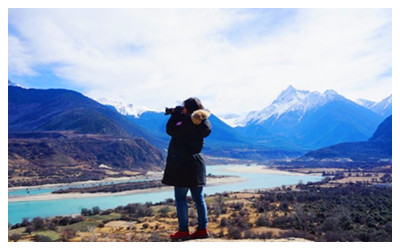 Originating from a glacier on the northern side of the middle Himalayas, over 5,300 meters above sea level, Yarlung Tsangpo River runs across the south of Qinghai-Tibet Plateau from west to east, through India and Bengal, and finally flows into the Bay of Bengal. Altogether more than 2,900 kilometers long with a catchment area of 935 thousand square kilometers, it is the fifth longest river in China. With a large number of branches, its natural hydropower capacity reaches up to 79,116 thousand kilowatts, just second to the Yangtze River in China.
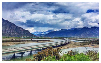 Yarlung Tsangpo River cuts through the Himalayas making a unique u-turn round Mt. Namcha Barwa before reaching Motuo (Medog County) and the famous Yarlung Tsangpo River Grand Canyon. The canyon is 496 kilometers long and is deeper than the Grand Canyon in America. It is, in fact, the deepest canyon in the world. In the innermost recesses of the canyon lies Motuo, the only county in China without a single road. It is like an isolated and mysterious 'Xanadu' seemingly outside the earthly world. Needless to say, it is best traveled on foot.
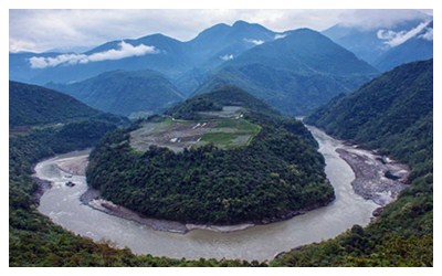 From the Pottery shard and stone objects of the Neolithic Period discovered in Nyingchi County, the ancient culture of Yarlung Tsangpo River can be traced back thousands of years. To some extent, it is the cradle of Tibetan civilization.
Travel Tips
Add:Milin County, Nyingchi County, Tibet of China
Entrance Fee: Cny 240
Opening Hours: 08:00-18:00
 Ask Questions ?


