
Skype: neodalle-travel
Tel: +86 135 7447 2266
E-mail: sales@visitaroundchina.com
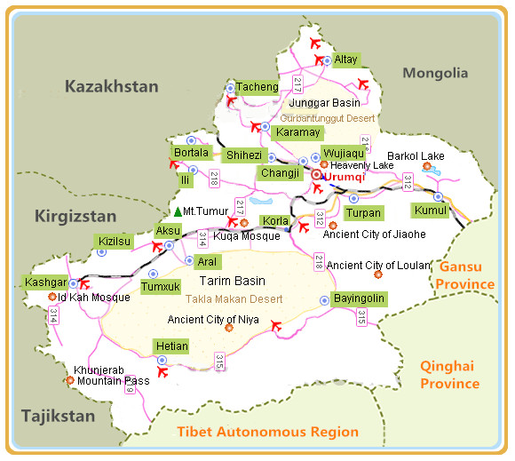 Bayingolin Mongol Autonomous Prefecture is situated in the southeast of Xinjiang, with neighboring provinces Gansu and Qinghai to the east. It is separated from Tibet by the Kunlun Mountains in the south. Within the Xinjiang Bayingolin Prefecture, it is bordered by Hotan in the west, and is in neighborhood of Ili, Changji, Urumqi, Turpan and Kumul with the Tianshan Mountains in the north acting as the boundary between Bayingolin and these regions.
 Bayingolin Facts
English Name: Bayingolin Mongol Autonomous Prefecture
Chinese Name: 巴音郭楞蒙古族自治州 (bā yīn guō lèng méng gǔ zú zì zhì zhōu)
Capital City: Korla
Area: 482,700 square kilometers (186,372 square miles)
Nationalities: Uygur, Hui, Mongol, Han
Administrative Division: 7 counties: Bugur (Luntai), Lopnur (Yuli), Qarkilik (Ruoqiang), Qarqan (Qiemo), Hejing, Hoxud (Heshuo), Bagrax (Bohu); 1 autonomous county (Yanqi Hui Autonomous County); 1 city (Korla)
Seat of the Prefecture Government: Bayin Dong Lu, Korla City,Xinjiang
History of Bayingolin
During the early years of the Western Han Dynasty (206BC-24AD), there were thirty-six city states and kingdoms in the western region of China and eleven of these states existed in the region of Xinjiang. Since the year 60BC, the central government began to set up protectorates to administer the area. When Korla was brought into the prefecture in 1960, the prefecture government simultaneously moved to Korla.
What to see in Bayingolin ?
The whole prefecture of Bayingolin fits into three morphologic regions: Tianshan Mountains, Tarim Basin and Kunlun-Arjin Mountains. Mountainous regions make up forty-nine percent of Bayingolin's territory. In addition, it has the Takla Makan Desert in the center and vast plains in the north.
 |
 |
 |
| Bayanbulak Grassland | Bosten Lake | Tarim River |
 |
 |
 |
| Loulan Ancient City | Xinjiang Lop Nur | Korla Iron Gate Pass |
When to visit Bayingolin?
The prefecture enjoys a temperate continental climate characterized by aridity, lack of rainfall, much evaporation and long daylight hours. In higher mountainous regions, there is no summer heat all the year round, while in the plain areas, the four seasons are distinct. September and October are the most ideal times to visit Bayingolin. The weather is moderate and there are fresh melons and other fruits in the market. The Swan Lake is full of water filled depressions. Visitors going there should be escorted by guides. The temperature in the Bayanbulak Grassland may change greatly, adequate clothing is suggested.
How to get to Bayingolin?
By Air : The new Korla Airport completed in October, 2007 is the second largest airport in Xinjiang. It is about 17 kilometers (11 miles) southwest of downtown Korla. At present, it mainly operates flights shuttling between Korla and Urumqi. In the near future, there will be more flights to some of the larger cities of China.
By Bus: Korla passenger transport center is seated in Beishan Lu, and visitors can take public busses No.2, 12, 19 and 26 to the bus station.
Bayingolin Travel Tips
Local Highlights: Bayingolin Mongol Autonomous Prefecture is the largest city-level administrative region possessing China's largest desert, longest inland river, largest inland freshwater lake, alpine grassland, diversified-leaf poplar protection zone, and the only forest park in a desert terrain and a swan nature reserve.
Special Local Products: Korla pear, fig, apocynum tea, grape, liquorice
 Ask Questions ?


